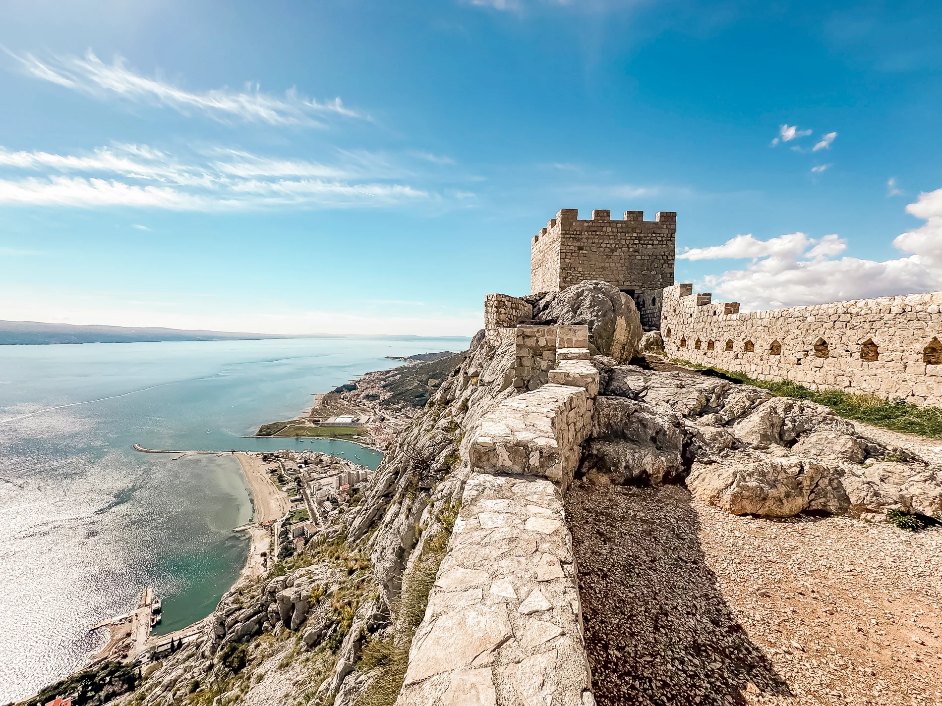
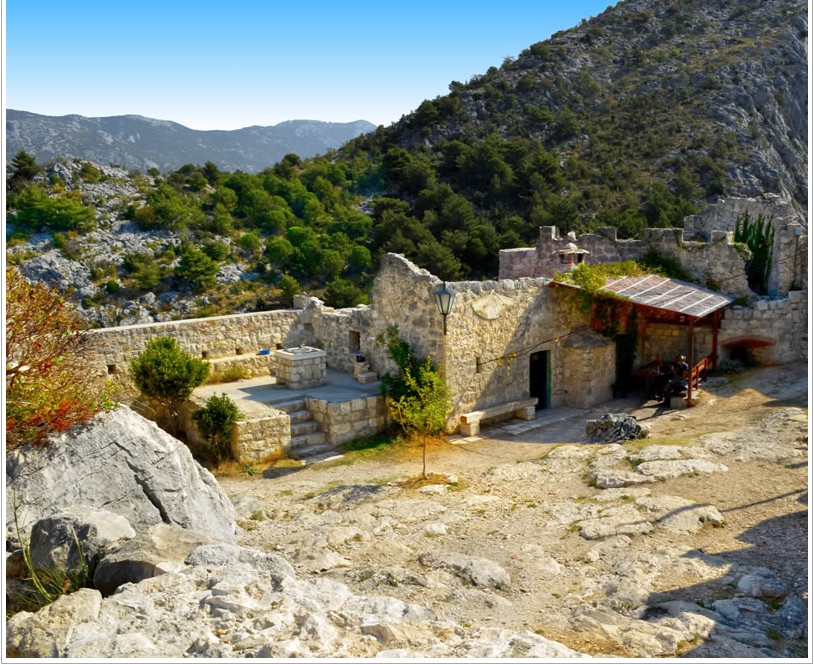
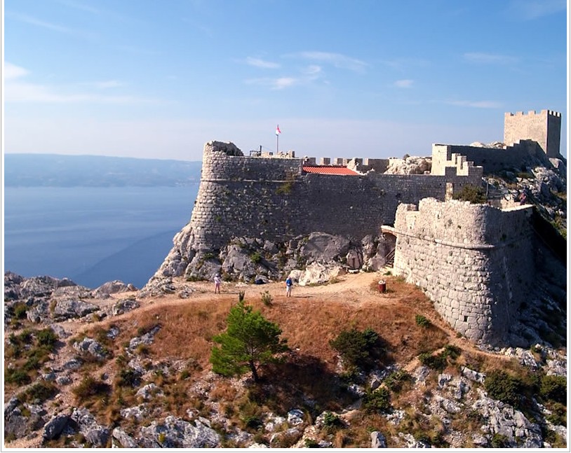
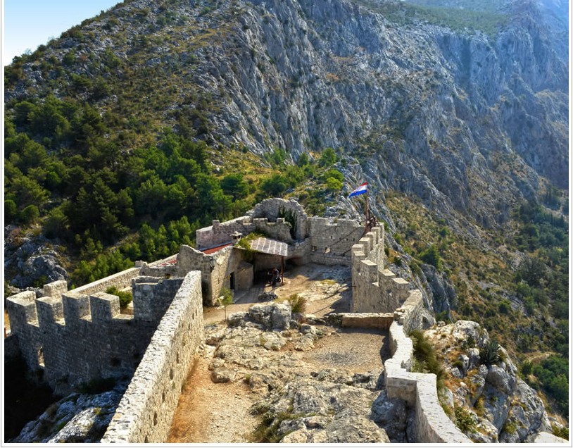
Fortica is a medieval fortress perched above the coastal town of Omiš. Built in the 15th century to defend against pirates and Ottoman invasions, it now stands as a symbol of the town’s rich history. Accessible via a scenic hiking trail, Fortica offers some of the most breathtaking panoramic views in Dalmatia – including the Cetina River canyon, the Adriatic Sea, and nearby islands.
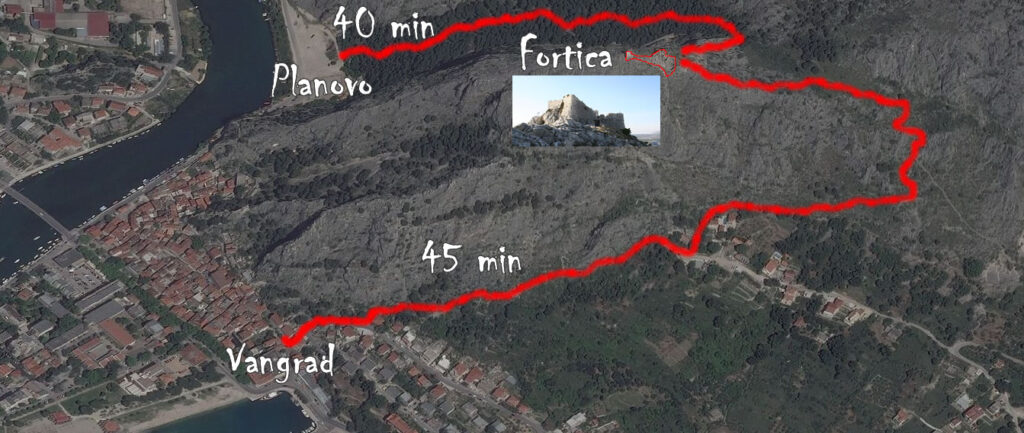
Hiking Trail from Omiš (Planovo) – Fortica – Omiš (Harbor) Length: 2.13 km Walking Time: 02:45 h Trail Marking: 601 Moderately Difficult Trail
The trail begins from Omiš (Planovo), behind the first tunnel on the right (signpost on the building). Following the markings eastward through pine forest, the trail leads uphill to the Fortica fortress (303m above sea level).
The trail continues from Fortica heading east and after 15 minutes of descent reaches a junction (x) with trail 602 (eastward to “Luda kuća” – southward to Omiš harbor), just above the hamlet of Baučići. The trail continues downhill southward on trail 602, passes through the hamlet of Baučići and ends at Omiš (harbor).
Trail Name: Omiš (Planovo) – Fortica – Omiš (Harbor) Start: Omiš (Planovo) – N 43° 26.819′, E 016° 41.687′ End: Omiš (harbor/fire station) – N 43° 26.559′, E 016° 41.678′ Walking Time: 02:45h Length: 2.1 km Elevation Difference: 287m Category: Moderately Difficult Trail Description: Omiš (Planovo), behind first tunnel on the right – Fortica (303m above sea level) – junction with trail 602, Baučići – Omiš (harbor) Trail Marking: 601
Please take note — never climb up to Fortica after 6 pm as it could be very tricky to climb down after it gets dark